Iceland roadtrip (1 week travel guide)
“It’s 1322 kilometres around the Iceland ring road.
We’ve got a tank full of gas, half a packet of salt liquorice, it’s dark…and we’re wearing sunglasses.
Hit it.”
Apart from the bit about it being dark, this Blues Brothersesque quote pretty accurately sums up our one week roadtrip around the beautiful, mesmerizing island of Iceland.
We travelled there in July, just after midsummer and hired a small 4x4 from Rejkjavik Airport before we hit the road. This guide is an account of that trip. I hope you enjoy it and find it valuable.
Day 1: Reykjavik Day Trip
After an easy car pick-up, we drove out of the airport, joining the procession of hired 4x4s, people carriers and tourist coaches ferrying tourists to the Icelandic capital and around the ‘Golden Circle’.
Our first impressions were unlike any I’ve had in other countries. In my experience, many airports are placed in semi-urban sprawl at the edge of cities, meaning your first impressions of new countries are inspiring sights like industrial parks, factories and shipping companies.
Unlike this though, Keflavik Airport is located a good 45 minutes outside of the capital, so we were immediately driving through open, untouched wilderness, the road a thin grey line with sparse vegetation and rocks for miles either side.
Arriving into the capital of Iceland was also a surreal experience. With a population of just over 120 000 inhabitants, Reykjavik is small and pretty easy to navigate. Before we knew it we had already reached the very centre of the city and quickly found a place to park near the City Hall. As well as being the city hall, it doubles up as a visitor’s centre, so we stocked up on maps of the city and wider area, as well as checking up on our options for whale watching and tourist trails.
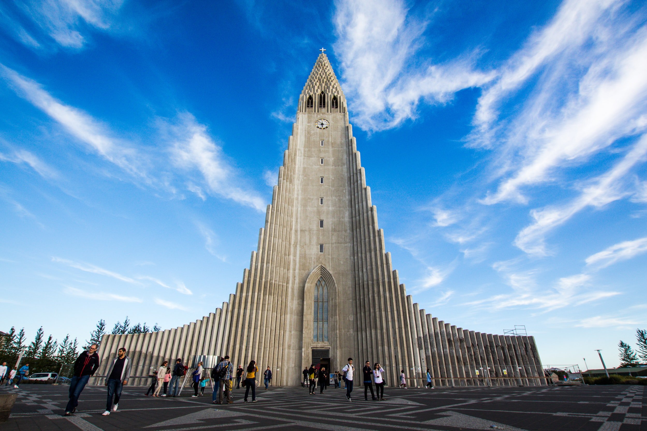
From there, I’d make your way round the quaint streets of downtown Reykjavik, heading in the direction of Skólavörðustígur (pictured above); the main shopping street, packed with cafes, shops and bars. We trekked up the street to step inside the incredible Hallgrímskirkja (pictured below), a cathedral situated on a highpoint in the city, giving views down on the rooftops and harbour beyond. The building is, perhaps not surprisingly, the tallest of its kind in Iceland and was built in 1986, with its architecture designed to mimic the volcanic basalt columns seen around the country. Take a look inside to see the beautiful white peacefulness of the interior and hear a blast from the vast organ.
We waved to the cheery figure of Leifur Eiríksson atop his pedestal outside the cathedral and walked down to the Harpa Concert Hall on the waterfront, a modern masterpiece of coloured glass and steel which, amazingly, doesn’t look out of place next to the corregated roofs and concrete blocks of most of Reykjavik.
Eating in Rekjavik
We ate at Ramen Momo that evening, a filling bowl of deliciousness and a crisp beer after a heavy day of walking. I’d definitely recommend at least one night staying in the city centre, offering you the opportunity to explore the winding streets on foot until late into the evening.
The sun sets at around 11pm in July and rises just before 4am, so just make sure you bring an eye mask to ensure your bodyclock doesn’t get totally and utterly confused!
Day 2 - The Golden Circle
Despite what we had thought, the roads leading to the most touristy of all tourist routes in Iceland were not congested. The Golden Circle comprises (amongst other amazing sights):
Gullfoss Waterfall
Geysir Geothermal Area
Þingvellir (Thingvellir) National Park.
Thingvellir National Park
Thingvellir was our first port of call and, as a history fan, it was the Thingvellir I was most looking forward to. This was the place which hosted the Alþing, the annual parliament or ‘assembly’ of Iceland from the year 930 until the last session held at Þingvellir in 1798.
The choice of location lies in the fact that this area marks the place where the North American plate meets the Eurasian plate, forming a spectacular rift valley. Although I’m quite sure the Icelanders of the 10th century who chose this place to hold their parliament didn’t know about its tectonic significance, it is a truly breathtaking site to behold.
Visitors to Thingvellir can park nearby and choose a number of routes from the visitor centre to explore the beautiful National Park and walk the edges of Þingvallavatn, the largest lake in Iceland.
Gulfoss Waterfall
Next up was the Gulfoss waterfall, a short drive from Thingvellir. Even though I had read about the falls beforehand, nothing could prepare me for what we were about to see. We arrived down a winding path from the visitors centre and heard the immense crashing of water before we actually saw it.
Every second, 141 cubic metres of water crash over the falls into a deep black crevice, with clouds of mist and foam billowing in enormous clouds from its depths. What is perhaps most spectacular for the eager tourists is the sheer scale of the falls, with almost 180 metres from one bank to the other. My attempts at photos did nothing to capture the size of this natural titan.
We left feeling exhilarated, refreshed and sure that nothing could beat our morning’s activities so far. Stopping for a quick pit stop at the Gulfoss visitor centre we pressed on, keen to beat the coachloads of tourists which were just arriving from the capital and discharging their matching-baseball-capped contents onto the carpark.
Haukadalur (aka: The place where Geysir is!)
The geothermal activity across the whole of southern Iceland is extraordinary - we were later to see basalt column caves, black magma sand beaches and the infamous Eyjafjallajökull volcano from the 2010 eruption. However, the Haukadalur Park was the area which most impressed me.
Arriving in our car along the busy tourist roads, we could already see plumes of sulfurous vapours rising into the air and, upon parking, the eggy smell of that sulfur reached our nostrils. We took the trails up through the fumeroles and deep pits of bubbling water until we reached the place where the visitors were congregating.
Coming from the Icelandic word ‘geysa’ meaning ‘to gush’, Haukadalur is home to several of this spouting hot springs. The so-called original ‘geysir’ is located here (alongside its younger sibling, the ‘Litli Geysir’) and, although somewhat unpredictable in its timing, can treat viewers to the sight of boiling water being fired 70 metres into the air (bring an umbrella!).
More waterfalls…
We might have completed the Golden Circle but that didn’t mean we were done for the day. Jumping into our trusty hire car we roared back onto the Route 1 and headed south with a few beautiful places in mind:
Seljalandsfoss Waterfall
This picture only gives a glimpse of how beautiful this waterfall is. A deep cave behind the flow of falling water gives visitors the chance to walk behind the falls.
Skógafoss
Fans of The Streets’ 2008 album ‘Everything is Borrowed might recognise this waterfall, which is one of the largest in Iceland with a 60 metre drop.
Seljavallalaug Pool
Built in 1923, this thermally-heated pool is exquisite in its simplicity. Do note that it is a short walk up to the pool from the nearest carpark - and the water is a little chilly in the area furthest from the hot water running from the rocks!
Fridheimar tomato farm 🍅
This place is so extraordinary it deserves its own subheading on the Day 2 section!
The geothermal activity in southern Iceland has been harnessed by the family owners of Fríðheimar farm to allow greenhouse grown plants to flourish throughout the year.
While I obviously recommended all the food businesses mentioned in this guide, if you visit only one make it this tomato farm. They offer visitors the chance to tour their spacious tomato greenhouses while they wait for a table at their restaurant, with tables placed amongst the rows of the blooming fruits.
And if you think a tomato-based menu is limiting - think again! There’s tomato-beer, tomato chocolate and delicious sauces and soups for hungry travellers to feast upon.
Staying in Vik
We arrived, weary and happy in Vik, a town with a population of 750 on the south coast.
The youth hostel was comfortable and cozy and, while we were tempted to hit the hay early we jumped back in the car after dinner and headed to the Reynisfjara beach, famous for its incredible black sands, dramatic rock stacks and a deep cave formed of volcanic basalt stacks.
Day 3 - Along the south coast
We started the day off with a walk above the small settlement at Vik, looking along the steep-sided grassy hills in search of puffins. These birds build their burrows in the soft soil above the town, with easy access to their fishing grounds out to sea and difficult terrain for predators to approach the nests. Happily, we saw plenty of puffins shooting in and out of their burrows, though I would encourage you to be cautious and watch your footing when traversing the steep hills here.
Fjaararyljufur canyon
The first stop on our list for day 3 was this fantastic canyon. This was one of the first times we had turned off the main highway of Route 1 and we began to realise why the 4x4 was necessary. The gravelly, bumpy road tested the cars suspension and, with so many tourists coming and going, we frequently had to pull into the uneven laybys at the side of the road.
We eventually made it to the Fjaararyljufur canyon and were not disappointed….
Image Credit: Kari Bjorn Photography
Seen from above, the river snaked its way through these steep sided canyon cliffs on either side. Visitors could approach on a number of well-worn paths, then descend to the level of the river at the entrance to the canyon to marvel at the mossy rock faces rising on both banks. If you get the chance, I would thoroughly recommend making the detour to Fjaararyljufur canyon.
Next up though, we were visiting one of the most beautiful locations on Iceland:
Staftafell (Vatnajökull National Park)
There are many beautiful walks and longer hikes to choose from in this national park. As we arrived in the carpark we could already see it was a hotbed for the nature enthusiasts, with large campsites and skipole laden hikers heading off on longer treks into the moutains and the Skaftafellsjokull glacier. We chose a relatively short walk out to the incredible Svartifoss waterfall - a 1.5 km hike which took about 40 minutes.
By now you’ve realised that there are a heck of a lot of waterfalls in Iceland. On the way to Svartifoss we even saw three other waterfalls; Þjofafoss (Thieves’ Fall), Hundafoss (Dogs’ Fall) and Magnusarfoss (the Falls of Magnus). What makes Svartifoss special is that the 20 metre glacial meltwater drop tumbles between giant black columns of volcanic basalt.
Slowly cooling lava forms these incredible columns which form perfect hexagonal shapes, much the same as the Giant’s Causeway in Northern Ireland and the cave we had already passed at Vik Beach.
If you are really feeling adventurous and have the time (which we sadly didn’t), Staftafell is a good starting point to reach the summit of Hvannadalshnjúkur, the tallest peak in Iceland. At the visitor centre you will also find a cafeteria as well as route guides and the possibility to book onto private travel tours who can take you up to volcanos and mountains in the area.
The southern area of Iceland where we were now driving is quite extraordinary to observe. Jet black lava fields spread as far as the eye can see on both sides of the road, with sparse shrub-like vegetation scattered here and there and not a single tree in sight. The road occasionally crosses fast-flowing rivers and streams from glacial runoff far to the north, but otherwise is an uninterupted line through this beautifully bleak and inhospitable landscape.
Jokolsarlon Glacial lagoon
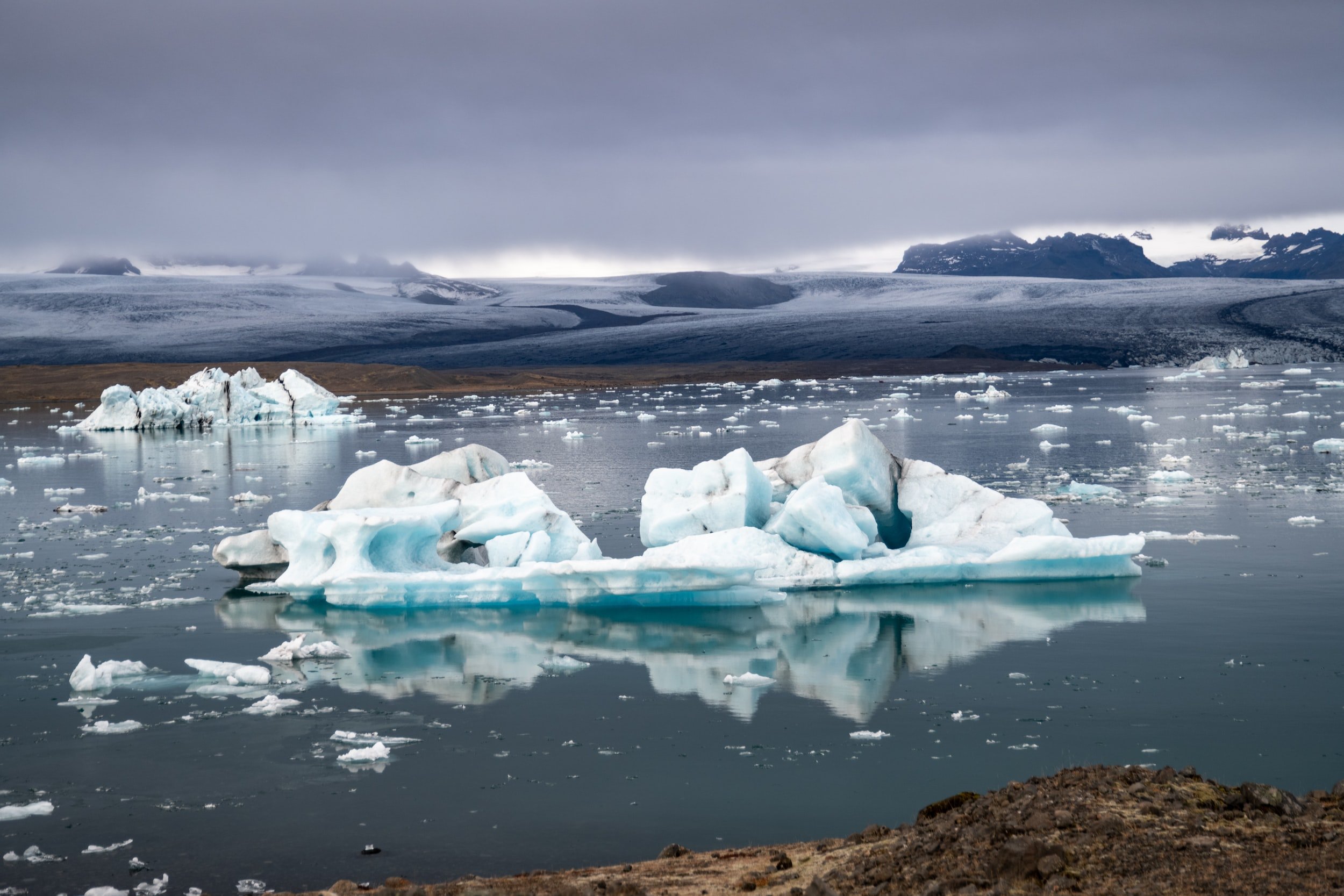
After a few hours of driving from Vatnajökull National Park we stopped at Jokolsarlon Glacial lagoon. This is one of many places which I would 100% recommend visiting during your visit to Iceland. The result of recent warming global temperatures, the lagoon is a place where the Breiðamerkurjökull meets warmer sea and ‘births’ huge blocks of ice which break off and float through the lagoon and out to sea as icebergs. It’s truly and incredible and a little sobering sight.
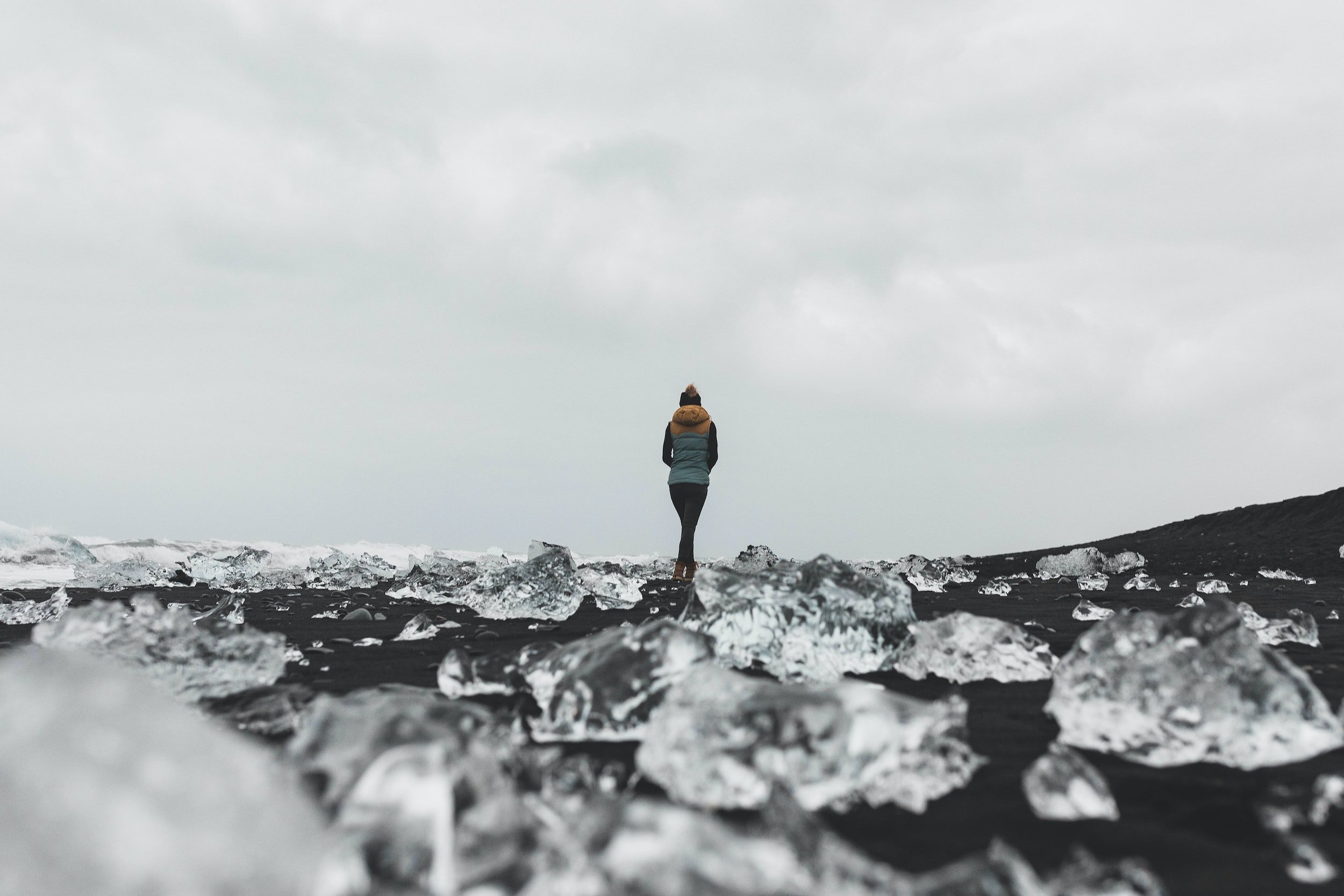
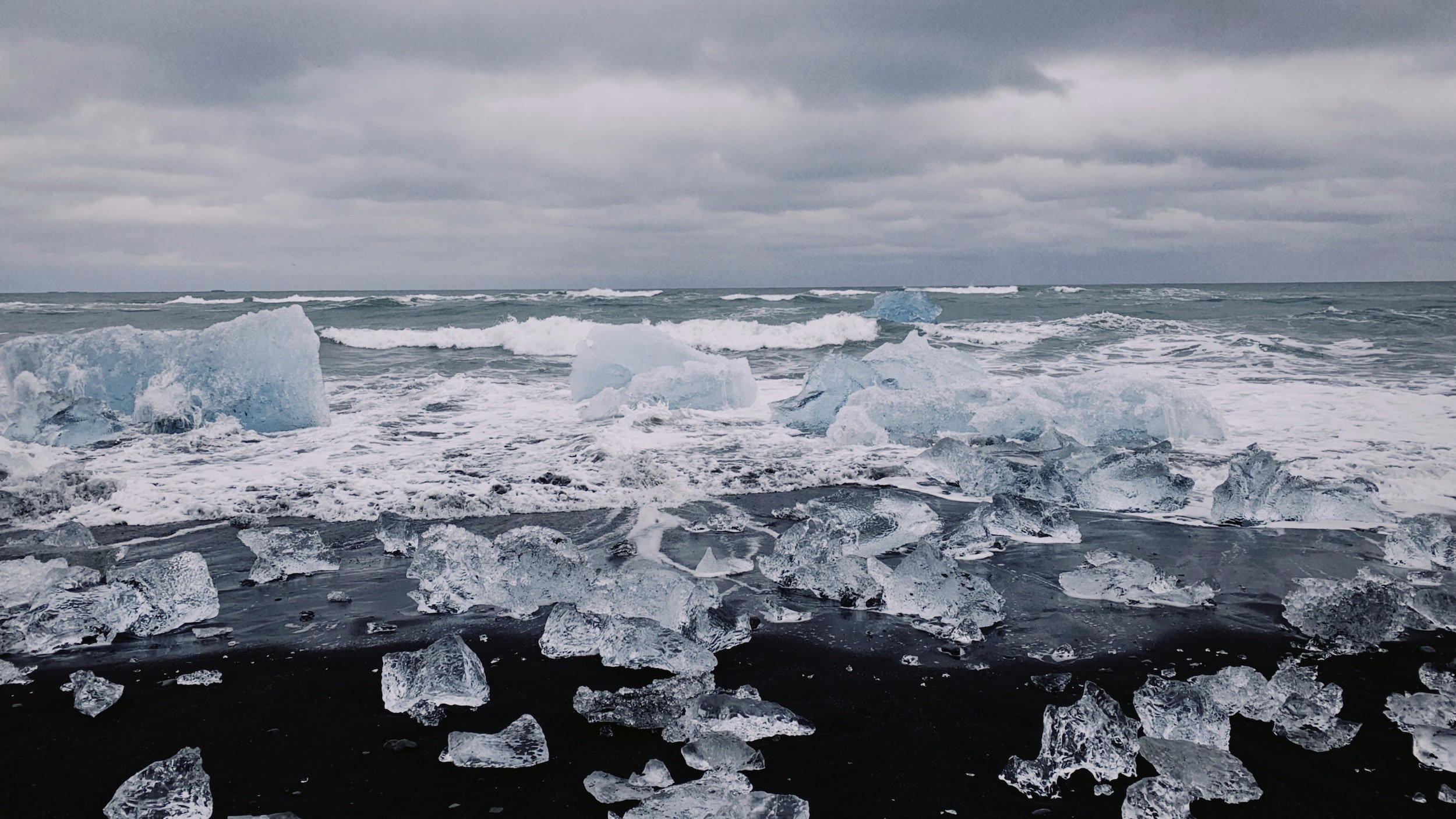
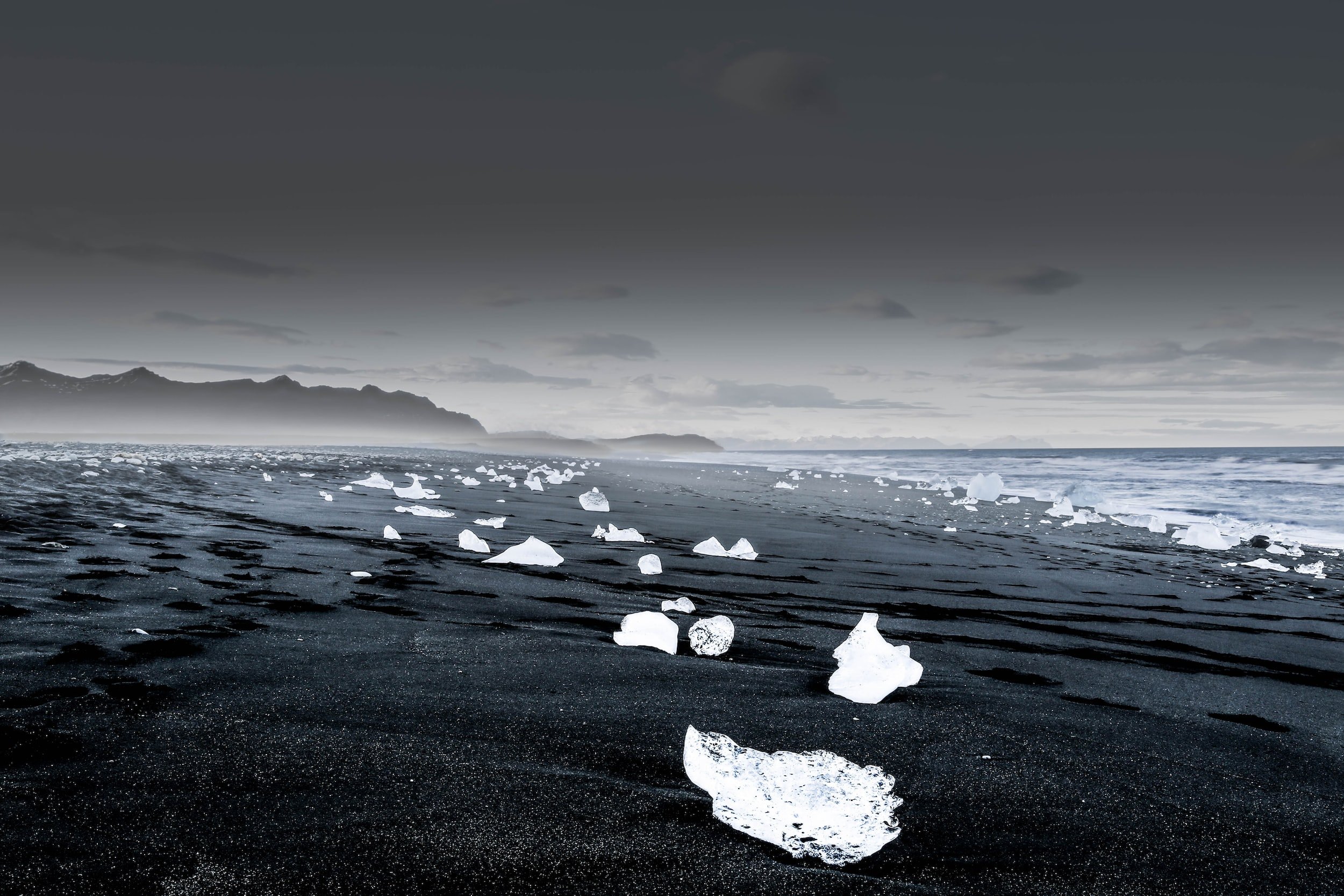
We also made the short hop from here to the socalled ‘Diamond Beach’. This is a beach which would be extraordinary in itself, with jet-black sand from the volcanic rock. What makes it even more special though are the rounded shapes of ice which wash up onto the shore from glacial lagoon’s icebergs which are washed up on the shoreline.
I’d recommend staying the next night in or close to the fishing town of Hofn, as we did. It’s well positioned on Route One for the next day of visiting the eastern fjords and is a good spot to rest up, stock up on travel essentials and recharge.
Day 4 - The Eastern Fjords
We set off from Hofn and continued along Route 1 for about 3 miles, making our first stop at the Stokknes viking village. It’s obviously not a real 1000-year-old viking village, but the vestige of a film set from 2010 for a viking movie (named Vikingr) produced by Universal Studios which never got off the ground. It’s very cool to walk around the houses and the setting of the massive Vestrahorn mountain peaks around makes you understand why the somewhat off-the -beaten-track location was chosen for this set.
While there, we stopped at the tourist cafe (The Viking Cafe!) and, while strolling along the coastpath and Stokknes black sand beach in the area, spotted a huge whale very close to the shore. Given that some tourists are paying big bucks to go out to sea on whale watching tours, we were ecstatic to spot a whale so close to shore. It even gave us a turn on its side so we could see the enormous scale.
Finished with playing at being vikings and with our cameras full of whale photos, we started heading north once more. We opted to turn off Route 1, taking a ‘shortcut’ which would cut of miles of coastal road and instead follow Route 95, which followed a series of steep-sided valleys further inland. The journey was needless to say, spectacular - offering us a quiet journey along a relatively untouched area of eastern Iceland, with far fewer tourists on the road.
Route 95 to Egilstadir
A word of warning about Route 95 is that the road is not paved tarmac like the ring road. Instead, this is an unpaved road of sandy gravel and grit, so it’s important you have a sturdy 4x4 vehicle for which you are comfortable driving in somewhat difficult terrain. We stopped several times in picturesque areas at the side of the road, taking in the scenery of untouched nature.
Along the way we saw incredible waterfalls cascading into empty pools of glistening water and descended down picturesque glacial valleys towards our destination that evening: the town of Egilstadir.
The ferries from Denmark and the Faroe Islands to the nearby town of Seydifjordur means that Egilstadir is a relatively large and well-equipped town in Icelandic terms (population: 2300), offering a supermarket, hotels, campsites, a museum, gas station, cafes and restaurants.
Day 5 - Onwards to Akureyri
That morning we headed to Seydifjordur, a small but beautiful village where a weekly car ferry MS Norröna of Smyril Line arrives from Hirtshals in Denmark and Tórshavn in the Faroe Islands. The town boasts picturesque wooden houses and, if you have time to set up camp here for a few days, would be a great spot for some trips out along the eastern Icelandic coast, with several trailheads beginning in the town.
Sadly, we had our tight schedule to follow so after a stroll around the town we hopped back in the car and set off north, rejoining Route 1 again. A couple of hours drive through vast open uplands and we turned off the road, heading first to the spectacular Dettifos. This waterfall is the second most powerful in Europe, boasting a 44 metre drop and almost 200 cubic metres of water passing over the falls every second. Definitely add this to your list when you are in this part of Iceland.
Exploring the martian landscapes of Námaskarð
Back on Route 1 and the green, fertile glacial valleys soon turned into more barren, dusty land as the road rose higher and higher. Soon we had reached the wonderful sounding Námaskarð Pass, an area of extreme geothermal activity which the road disects. As the picture shows, this whole area is a kind of landscape almost unknown to many travellers. It gave us the feeling of visiting a martian, alien landscape of strewn boulders, towering peaks, fumaroles gushing sulfurous smoke and boiling mud pools, Take a stop here at the multiple laybys and parking spots before you reach the nearby site of Lake Myvatn.
Covering 36 square kilometres, Lake Myvatn is a body of water which is home to geothermal hot springs, with multiple campsites and roadside cafes scattered around its banks The small town of Reykjahlíð hosts a small supermarket, gas station and hotel. Sticking to our fairly strict schedle, we ate lunch at the visitor centre at Lake Myvatn, overlooking the hotsprings, before pressing on in the direction of Akureyri.
If you have time though, I’d definitely encourage to spend a day exploring the area and the so-called ‘Diamond Circle’ which encompasses several incredible sites in the region.
We did have time to stop off at some truly spectacular sights along the way to Akureyri though:
Skútustaðagígar Craters
These ‘pseudo craters’ are made by lava flows pressuring the ground downwards as it passes. We parked nearby and walked around these beautiful craters, taking some idyllic photos with the misty myvatn lake hiding in the background.
Grjótagjá Cave
This lava cave is a hot spring which has been used for hundreds of years. It was even used for filming Game of Thrones - you know the scene with Jon Snow and Ygritte?
Goðafoss Waterfall
I can’t recommend this waterfall enough. It’s Icelandic name means ‘Waterfall of the Gods’, with the horseshoe shape of the falls said to be formed by a hoofprint from Odin’s eight-legged steed Sleipnir. I think it really deserves the god-like comparison, with 30 metres of ice-blue water cascading over a 12 metre drop.
A 45 minute drive from Goðafoss took us to Akureyri, the second most populous area in Iceland outside of the south-west corner where Rejkjavik sits. Here you’ll find plenty of accomodation options, as well as large supermarkets to restock on essentials. We sadly didn’t have time to stay here long, but the town itself has a museum of Akureyri’s history from the Viking age, as well as multiple boat trips to outlying islands and trailheads to explore the beautiful surroundings.
Day 6 - The big drive to Skykkisholmur
We knew from the start that day 6 was going to be a big day of driving for us. Stocked up on driving essentials and with our roadtrip playlist blasting, we set off early from Akureyri. Passing hump-backed mountains and undulating hills we had our sights set on one of Iceland’s largest seal colonies. Turning off Route 1 we took a bumpy road up to Hvitsekur rock, a 15 metre high black basalt rock which stands out sharply against the grey beach, grey mountains, grey waters and grey skies beyond!
Close to the rock we made out several colonies of seals. Mistaking them at first for black rocks scattered among the sand, we saw their shuffling shapes shambling into the sea and realised there were hundreds of seals basking in the semi-sunny Icelandic summer!
Onwards to the community pool at Hofsos which I thoroughly recommend. Several travel guides I have read have mentioned that the pool was crowded with tourists when they arrived, but it was very quiet when we visited in mid-July.
We spent a lovely hour in the geothermally heated infinity pool, bobbing backwards and forwards and taking in the ecquisite views out to the Trollaskagi headland and the white horses on the seas beyond. It is well worth the trip, particularly if you are in the middle of a long roadtrip and need a much needed rest in warm waters!
From Hofsos we turned off Route 1 again, this time taking the picturesque route 59 (Laxárdalsvegur) a ‘scenic-mountain journey’ which headed west across green heathland, with not a sign of human habitation for mile upon mile. The fact that this road is listed on a website called ‘DangerousRoads.org’ means you should approach this unpaveed, wild road with care and avoid it in winter.
Stykkishólmur
We finished our day by finding our air bnb in the small fishing village of Stykkishólmur, a pretty settlement with colourful houses dotted around the coastline (see image below). We were staying in a reused fisherman’s cottage, and the owner had left us caviar which was just what we needed after our long drive, washed down with only the finest of lagers: Carlsberg.
Due to the town’s location as a port for the car ferry to the north-west of Iceland, there are multiple cafes and restaurants at the harbourside, as well as shops to stock up and a tourist office to find out more about the local area.
With the sun setting here in July at 11.30pm (and rising a couple of hours later!) we stayed up to take photos of the dipping sun beside the red-roofed Súgandisey Island Lighthouse.
Day 7 - In my end is my beginning
We had almost completed our roadtrip around Iceland and the final day left us with a lot to do.
We headed off south from Stykkishólmur and headed west to the end of the Snæfellsnes peninsula, a small detour but worth the extra effort to visit the extraordinary Vatnshellir cave network. These are a series of 8000 year old lava caves, formed by the surface lava from an eruption coming into contact with the cooler air and turning to rock, while the lava underneath continued to flow away, leaving these incredible lava tube caves behind.
Booking a tour with a qualified guide is neccessary as the caves are pretty treacherous. We entered through a metal door that looked like a cold war bunker, then descended down a winding spiral staircase into the depths of the lava tube. We were all kitted out with helmets, appropriate footwear for the uneven rocky floor and headtorches to explore the pitch black interiors.
At one point our guide made us turn out the torches, plunging us all into absolute darkness, which was, to say the least, a little unsettling! It’s really an incredible experience to explore the caves for an hour and there are several options when it comes to booking a tour.
We had the last day ahead of us and jumped back into the car, taking a quick stop to view the breathtaking black basalt cliffs at Londrangar as the waves smashed into them and the seabirds wheeled in their thousands to delicate nests perched precariously on the hundred metre cliffs.
Next up we headed back onto Route 1 with Reykjavík in our sights. Along the coast, we stopped off at a few picturesque spots along the way which are well worth a stop if you have time:
Dritvik Cove
Stop by this cove, which was once the busiest fishing harbour in Iceland, with a fleet of 60 boats at its peak. The rusted remains of a shipwreck on the beach are from a British fishing vessel which hit the rocks in the 1960s.
Borganes
We stopped at the small town of Borganes due to its large, thermally heated pools - fed by the Deildartunga hotspring. With the snow-capped peaks in the background, you can sample the different outdoor hotpools (which reach 40 degrees!) and try the water slides!
Suddenly there we were. The empty roadsides and sprawling grassy foothills we had grown used to over the past week gave way to suburban streets and parking lots as we entered the outskirts of Reykjavík. We found our Airbnb in the city centre and ended our holiday with a relaxing stroll through the picturesque streets of the capital.
There you have it. We saw some incredible sights in the 7 days we were in Iceland and I only wish we could have stayed there longer and explored more of this fantastic island.
I hope this guide is useful to you! Reach out if you have any questions or leave a comment below if you have suggestions or ideas from your own visits to Iceland which could be added to this guide.
Planning a trip to Scandinavia?
Why not check out my guides to:
Gothenburg in Sweden
The Lofotens in Norway
Or explore the rest of the Scandi Culture Experiences to find out what’s on offer.


